
Global Forest Watch and other research sources (see the “Where do we get data” tutorial) use satellite imaging. It is a good idea for GFL student participants to understand how this works.
What is satellite imaging?
Satellite imaging, or remote sensing, is the scanning of the earth by satellite or high-flying aircraft in order to obtain information about it.
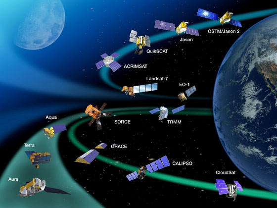
There are many different satellites scanning the Earth, each with its own unique purpose.
Satellites use different kinds of sensors to collect electromagnetic radiation reflected from the Earth. Passive sensors collect radiation which the Sun emits and the Earth reflects, and don’t require energy. Active sensors emit radiation themselves and analyze it after it is reflected back from the Earth. Active sensors require a significant amount of energy to emit radiation, but they are useful because they can be used during any season and time of day (passive sensors cannot be used on a part of Earth that is in shadow) and because they can emit types of radiation that the Sun does not provide.
Satellites and the EM Spectrum
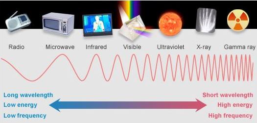
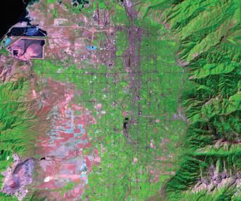
While humans can perceive only a small portion of the EM spectrum (visible light), satellite sensors can use other types, like infrared light, ultraviolet light, or even microwaves. When satellite images are made, these invisible types of light are assigned a visible color. That is why satellite images, like the one on the right, often have “unnatural” colors.
Analyzing satellite images
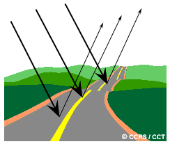
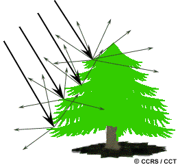
Satellite images are useful because different surfaces and objects can be identified by the way they react to radiation. For instance, smooth surfaces, such as roads, reflect almost all of the energy which comes at them in a single direction. This is called specular reflection. Meanwhile, rough surfaces, such as trees, reflect energy in all directions. This is called diffuse reflection. Sensing different types of reflection is useful in measuring the density and amount of forests, and forest change.
Also, objects react differently to different wavelengths of radiation. For instance, there is a frequency of infrared light which can be used to determine plant health. Healthy leaves reflect this frequency well while unhealthy ones do not.
The Landsat Series
To track tree cover changes, Global Forest Watch uses images collected by Landsat satellites. The Landsat series, issued by NASA in 1972, was the first designed specifically to monitor the Earth’s surface. Its 40 years of satellite data are invaluable to analyzing changes in areas such as climate, forest cover, water sources, and air pollution over time. Landsat images are used in many fields, including agriculture, geology, forestry, regional planning, mapping, and global change research.
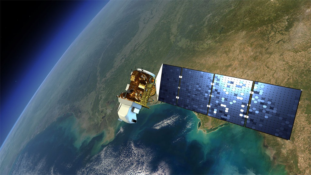
The Landsat-7 Satellite in 2013
Would you like to know more?
If you’re interested in satellites and satellite imaging, try these links:
Fundamentals of Remote Sensing – tons of information from the Canada Centre for Mapping and Earth Observation.
Landsat Sattelites – a short but comprehensive tutorial on the Landsat series.
Remote Sensing News – the latest news about remote sensing and its discoveries.